
Walk a Richland Street by Address
Begin with the most complete street number and street name available. One spelling error can hide the parcel, and an old mailing line may no longer match the current postal code. The aim is to build a chain of dated records, not to turn one search result into a claim about every occupant. In Richland, owner, voter, permit applicant, and directory listing are distinct roles.
- Run the number and street through the Benton County Property Search, choose Richland in the city field, and save the parcel or Geo ID.
- Open the county GIS hub to place the parcel among adjoining lots, roads, and available public map layers.
- Use the published parcel name as a lead in Benton eRecording, then check grantor, grantee, dates, and legal-description links.
- Ask Richland Development Services for permit or inspection files when the online permit path does not reach the needed year.
- For a dated household snapshot, compare the address with a Tri-Cities or Hanford-era directory rather than assuming current occupancy.
This order keeps the inquiry tied to a place. The parcel ID and legal description are usually more durable than a mailing address, especially after a split, plat, or postal change.
Richland Street Directory Search Fields
The Benton County Property Search has separate Property Search, Sales Search, Map Search, and Map Administration tabs. Use the property tab for an address first. A partial street name may work, but adding Richland and a street number sharply narrows a long result list.
| Portal control | Richland address use | Important detail |
|---|---|---|
| Street Number | Enter the building number | Text field, with 1234 shown as an example |
| Street Name | Enter full or partial name | Main is the portal example |
| City | Select Richland | Separates city results from the wider county |
| Parcel # / Geo ID | Repeat an exact parcel search | More stable than a mailing line |
| Subdivision and legal filters | Recover a parcel when an address fails | Includes condo, abstract, township, range, and section |
| Appraisal Year | Choose the relevant tax year | Current ownership is directed to the 2025–2026 display |
The parcel card can show the situs address, legal description, published owner data, assessed values, sales, plot facts, and map detail. Situs means the physical property location. It may differ from the owner's mailing address.
The official property portal is shown below with its visible address and legal controls.
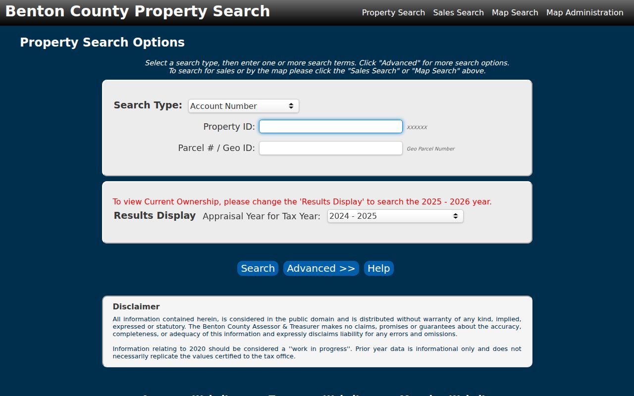
Those fields make the portal useful by address, parcel identifier, subdivision, or legal geography, but its parcel card is not a resident roll.
Richland Records Indexed by Street
Each custodian answers a different part of a Richland street directory question. The strongest result comes from preserving dates and record identifiers while moving between offices.
| Address record | Custodian | What it can establish | Access route |
|---|---|---|---|
| Parcel and value | Benton County Assessor | Parcel, situs, legal description, published owner, value, sales | Free Property Search or assessor contact |
| Map context | Benton County GIS | Parcel and available road or public-works geography | Free GIS hub and web maps |
| Recorded instruments | Benton County Auditor | Deeds, liens, easements, plats, and releases | Online index, historical index, mail or office copy |
| Permits and inspections | City of Richland | Dated building, alteration, plan, and inspection trail | EnerGov or focused public-record request |
| Historical listings | Library and genealogy collections | Name or phone listed at an address in a given year | Library databases, shelf volumes, or research help |
None is a complete list of residents. A deed establishes a recorded transaction, a directory gives a dated listing, and the assessor describes a parcel for a stated appraisal year.
Map Richland Streets and Parcels
The Benton County GIS hub is the map doorway for county data. Public Works also links traffic counts, monuments, road approaches, closures, snow removal, utility encroachments, and right-of-way material. These layers can explain why a road line and parcel edge do not tell the same story.
The official GIS landing page is pictured below.
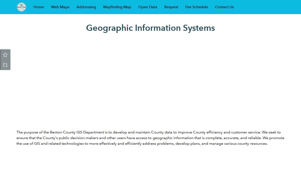
The capture confirms the map hub, while exact dynamic layer names and popup fields were not exposed in the research. Do not claim a layer or field until it appears in the live viewer.
County addressing follows E911 rules, yet its Master Address Viewer covers unincorporated areas. Incorporated Richland address questions belong with the city. That geographic split matters when a street sits near the city boundary.
Follow Richland Deeds Behind Addresses
The assessor gives the parcel lead. The Benton County Auditor Recording Division supplies the recorded-document trail. Its online index starts in January 1971, while Historical Document Indexes reach from 1906 through 1971. Older work may require the historical index, Archives, a copy request, or staff research.
Search a known owner as grantee to find an acquisition, then as grantor to find a later transfer. Narrow by date and document type. When names change or repeat, subdivision, block, lot, reception number, and legal description help keep the chain attached to the same land.
- Parcel
- A mapped unit of land assigned an identifier for assessment and record matching.
- Plat
- A recorded map that lays out lots, blocks, roads, or a subdivision.
- Legal description
- The land description used in recorded instruments, often more stable than a street address.
- Criss-cross directory
- A directory arranged by street and number, useful for a dated listing rather than proof of title.
Non-certified copies cost $1 per page. Certified copies cost $3 for the first page and $1 for each added page. Staff research is $8 per hour with an $8 minimum. A mailed order should state a not-to-exceed amount, and work generally waits for payment.
Connect Richland Street Instruments
Benton eRecording accepts grantor, grantee, or combined party searches. Basic name mode is order-sensitive and uses last name first. Advanced mode treats words more flexibly, while an asterisk supplies a wildcard. Document type, recording dates, reception number, subdivision, block, and lot can all refine a street packet.
The official eRecording help screen documents those controls and the Find Related action.
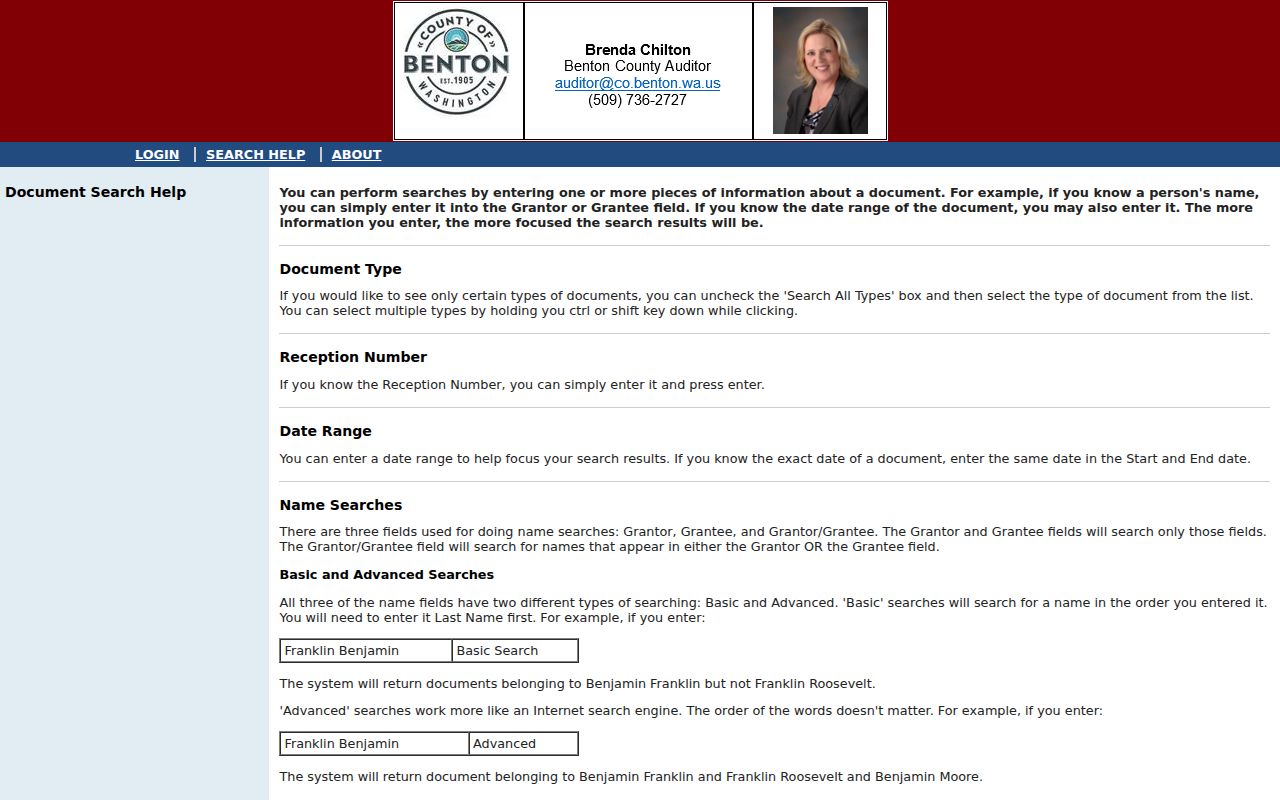
Find Related can connect documents that share a legal description or refer to the current document. It is especially useful after a street address changes but the recorded land references remain consistent.
Richland Address Clues Beyond Numbers
An address may be missing even when land exists. Benton County says vacant land generally receives no address, while a residence normally receives one with a building permit. Short plats and subdivisions can carry temporary addresses with a T prefix, and that number may change once a permit issues.
For an incorporated Richland parcel, ask city staff about the city address. Keep the temporary number, final number, legal description, and permit date together. A failed modern-address query does not mean the older record is absent.
Note: Search name variants, former numbers, subdivision and lot, parties, and an approximate year before treating an old Richland address as a dead end.
Richland Street Permits Changed Systems
Richland moved permitting to EnerGov on June 3, 2024. The newer workflow handles submissions, review status, corrections, comments, plans, fees, and inspections. Development Services is the right custodian for construction, repair, alteration, demolition, and occupancy material tied to a street.
Older applications may require contact with permit staff or a focused request through the Richland public-records page. Give the exact address, date range, permit or inspection type, and department. The city lists Toni Fulton as City/Fire Public Records Officer at 509-942-7619, with mail at 625 Swift Blvd., MS-07, Richland, WA 99352.
A permit applicant or contact is not necessarily an owner or resident. Use the file for dated building history, then compare its parcel and legal facts with the assessor and recorded instrument.
Richland Streets Across Two ZIPs
USPS created the 99354 Richland delivery area on July 1, 2004 and moved part of the former 99352 area into it. An older directory may therefore show 99352 while a modern result shows 99354 for the same place. The postal change alone does not prove that a street or household moved.
Validate the full modern mailing line with the USPS ZIP Code Lookup. Preserve the older ZIP exactly as printed and date each record. USPS also warns that its result does not confirm a person or company at the address.
Historic Richland Streets Tell More
Richland's wartime building record adds context that a modern street directory cannot. The National Park Service Alphabet Houses history says the first B house began construction April 28, 1943 and was occupied July 30, 1943. More than 4,300 alphabet homes existed by early 1945.
The Gold Coast neighborhood followed in 1949 near the Columbia River. These house types and district names can point to maps, floor plans, and period sources. They do not identify a current resident and are not substitutes for a deed.
A dated historical listing is handled more fully on the Richland city directory page. For a street packet, record the directory year and page beside the parcel, deed, and permit evidence.
Limits of a Richland Street Directory
No official source found in the research publishes a complete street-by-street list of Richland residents. The assessor is parcel-centered. A voter record reflects registration and carries statutory use limits. A deed names parties to an instrument. A directory listing only supports that a name appeared at an address in its stated year.
Washington's public voter extract is not an anonymous people finder. VoteWA is a registered voter's self-service portal, and the public extract is governed by RCW 29A.08.720. Ballot choices are not included. The Department of Licensing source and a person's decision not to register remain confidential.
Lawful use. Use Richland address records only for lawful personal, family-history, property, or civic research. Never use them to stalk, harass, threaten, or harm anyone.
When evidence conflicts, preserve each source's date and wording. Ask the custodian for the underlying record instead of filling a gap with an inference.
Build a Richland Street Record Packet
A useful street packet keeps the evidence in street order and source order. Record the street name exactly as each source prints it, then add the parcel ID, legal description, appraisal year, reception number, permit-year lead, directory issue, and postal line. A simple sequence exposes gaps without pretending that all records describe the same date.
Start a fresh row when the legal description changes. A lot split, combination, new plat, or temporary T address may mean the modern parcel does not match the older land unit. Read the recorded plat or instrument before joining two parcels. Save book and page from a historical index so the Auditor can locate a copy even when no image appears online.
- Exact printed street number, name, suffix, and ZIP
- Parcel, Geo ID, appraisal year, and legal description
- Grantor, grantee, document type, date, and reception number
- Permit or inspection type, date range, and city department
- Directory title, publisher, issue year, page, and entry type
This evidence checklist also prevents a common error: treating an owner name as a household list. Label every fact by source, role, and date.
Request Missing Richland Street Records
An online portal is only one access channel. The Auditor accepts copy requests for recorded instruments and can use a year, book, page, reception number, party, or legal description. Its office is at 7122 W Okanogan Pl., Building E, Kennewick, WA 99336, with phone 509-786-5616. Public login searches do not include every document image, while registered image access depends on the subscription level.
County administrative records can be requested through the Benton County Public Records Portal. City-created permits, inspections, code files, and public-works records belong with Richland. Under the Washington Public Records Act, an agency generally responds within five business days by producing records, acknowledging the request with an estimate, seeking clarification, or citing the basis for denial. The office need not create a record that does not exist.
Ask narrowly. Give the Richland address, alternate number, date range, department, and record type. Request the index or file as kept, and expect lawful redactions where an exemption applies.